

Key Takeaways
- Integrating advanced technologies, such as GIS, drones, and AI, enhances the accuracy and efficiency of land data management.
- Adopting cloud-based platforms facilitates real-time collaboration and data sharing among stakeholders.
- Implementing standardized data collection and storage practices ensures consistency and reliability in land records.
In today’s rapidly evolving landscape, effective land data management has become a cornerstone for success in surveying and development. The volume and complexity of information required for responsible land planning are higher than ever before, and professionals must find ways to collect, process, and interpret data efficiently. Leveraging innovative resources such as land owner maps and advanced analytics, surveyors and developers can reduce redundancies and accelerate project timelines. Land data is crucial for project decisions, reducing risks and regulatory issues. Clear communication and data transparency are essential for surveying and development. Modern data management enhances accuracy, streamlines workflows, and boosts project success. Accurate, secure, and accessible land data is essential for trustworthiness and stakeholder engagement. Staying updated with industry advances, such as real-time data streams and spatial analytics, facilitates better coordination among planners, regulators, engineers, and communities.
Leveraging Geographic Information Systems (GIS)
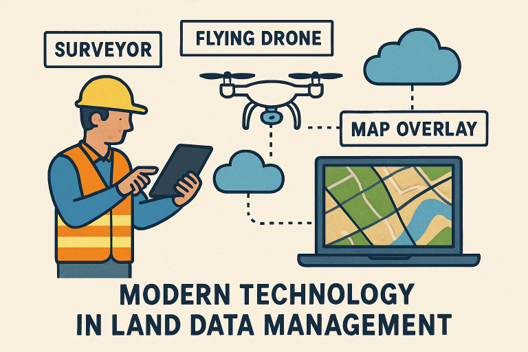
Geographic Information Systems (GIS) are essential for modern land data management. These platforms enable surveyors and developers to combine data layers like property lines, topography, zoning, and infrastructure into a single interface. They allow spatial analysis to assess land use trends, site suitability, environmental risks, and project impacts before construction. GIS enhances stakeholder engagement by making complex spatial data accessible and visual, useful for regulatory reviews, community presentations, and asset management. New GIS platforms offer cloud connectivity, mobile accessibility, and AI, providing decision-makers with up-to-date information wherever they are.
Utilizing Drone Technology for Data Collection
Drones, or UAVs, are essential in surveying, using high-res imagery and LiDAR to quickly and accurately gather topographical data without large crews. They access remote or dangerous sites efficiently, providing surface models, volumetric data, and vegetation info. This reduces project time and costs, enabling quick validation and risk response. Drone mapping facilitates site monitoring, progress tracking, and compliance.
Implementing Cloud-Based Data Management Systems
Adopting cloud-based data platforms boosts efficiency and collaboration in land data management. Field teams send georeferenced data to central servers, enabling architects, engineers, planners, and clients to review real-time updates from anywhere. This streamlines workflows, improves security and transparency with automated backups, version control, and role-based access. Custom dashboards track milestones and approvals. Faster turnaround and data sharing speed up project approval and delivery, especially as projects grow more complex.
Standardizing Data Collection and Storage Practices
Consistency is key in trustworthy land data management. Standardized procedures for data collection and archiving ensure uniformity and comparability across projects. Standards should cover data formats, accuracy, metadata, and backup protocols. Standardization aids integration with new technologies, ensuring compatibility with GIS, BIM, or AI tools. It also facilitates compliance and the sharing of records with auditors or authorities. Training field teams and adopting recognized protocols boost reliability and trust.
Integrating Artificial Intelligence (AI) and Machine Learning
AI and machine learning are rapidly expanding in land surveying. AI analyzes satellite and drone images, automates feature recognition, streamlines quality control, and detects data patterns. Machine learning enhances system accuracy over time, reducing manual effort and accelerating validation. Future AI advancements will automate report creation, risk assessment, and project management integration, transforming land surveying into a highly automated, data-driven field for better stakeholder outcomes.
Conclusion
Surveyors and developers face mounting pressure to deliver fast, accurate, and compliant project results. Achieving these goals depends on adopting cutting-edge technologies such as GIS, drones, cloud platforms, and AI, while also standardizing data management methods across the workflow. These advances make land data more accessible, reliable, and actionable, directly supporting better project decisions, risk mitigation, and long-term value creation. As land data continues to play a defining role in sustainable urban and rural development, ongoing investment in digital transformation is not just recommended—it’s essential.